Professional City Sand Table Model Custom Service
Introduction
A city plan is a promise.
It guides growth, investment, and quality of life.
But a plan on paper is hard to grasp.
Digital screens feel distant.
You need a physical representation.
A Professional City Sand Table Model built to your exact specifications.
This guide explains why custom models matter.
What the service includes.
And how to get one for your municipality or project.
Let us begin.
What Is a Professional City Sand Table Model?
It is a high‑precision, custom‑built miniature of a city or district.
Constructed by expert model makers using advanced fabrication methods.
A Professional City Sand Table Model integrates land use, transportation, infrastructure, and public facilities into one coherent display.
Unlike off‑the‑shelf models, this one is tailored to your GIS data, zoning maps, and master plan.
Every building footprint, road, and park is accurately placed at your chosen scale.
Why Choose a Professional Custom Service
Urban planning requires accuracy and durability.
A professional service guarantees both.
With a Professional City Sand Table Model, you get:
GIS precision – Buildings and roads aligned to real coordinates.
Architectural detail – Massing blocks and iconic landmarks.
Durable materials – Laser‑cut acrylic, reinforced bases, protective covers.
Custom finishes – Zoning colors, labels, and legends.
Lighting options – LED integration for phasing and transit lines.
Professional models support public hearings, council presentations, and investor outreach.
Key Features of a Professional City Model
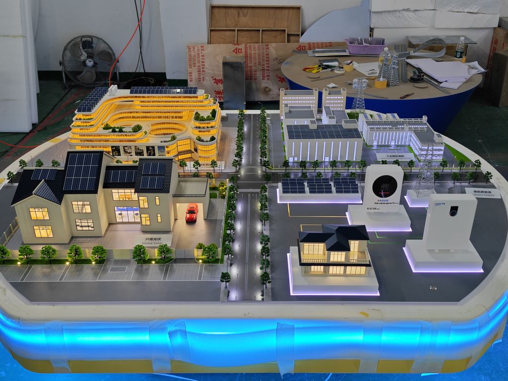
Let us break down what a high‑quality custom model includes.
Accurate Land Use Zoning
Residential (yellow), commercial (red), industrial (blue), mixed‑use (orange), open space (green).
Standard colors with a clear legend.
Transportation Networks
Road hierarchies, transit lines, bike lanes, and pedestrian paths.
Referencing an Urban Traffic Planning Sand Table Model for mobility detail.
Infrastructure and Utilities
Simplified water, sewer, power corridors (optional overlay).
Public Facilities
Schools, hospitals, fire stations, libraries, government buildings.
Linked to a Public Facility Planning Scale Model for service equity.
Topography and Water Features
Sculpted hills, rivers, lakes, and coastlines.
Phasing and Future Growth
Phase 1, 2, 3 distinguished by color or LED indicators.
Protective Cover and Base
Clear acrylic cover and reinforced MDF or aluminum base.
The Custom Service Process
A professional custom service follows a structured workflow.
Step 1 – Consultation and Data Collection
You provide comprehensive plan maps, GIS data, and any specific requirements.
The model maker assesses scale, detail level, and budget.
Step 2 – Scale Selection and Digital Modeling
Common scales: 1:2,000 to 1:20,000.
A digital 3D model is created for your approval.
Step 3 – Fabrication
Laser cutting, 3D printing, and hand assembly.
Terrain sculpted where needed.
Step 4 – Painting and Landscaping
Zoning colors applied.
Trees, parks, and water features added.
Step 5 – Quality Control
Every detail checked against source data.
Step 6 – Delivery and Installation
Model crated and shipped.
On‑site setup with protective cover.
A typical Professional City Sand Table Model takes 8 to 14 weeks from order to delivery.
Materials and Craftsmanship
Professional models use museum‑quality materials.
Cast acrylic – For building massing and water bodies.
High‑density MDF – For bases and terrain.
3D printed resin – For custom landmarks.
Fine sand and flocking – For ground and vegetation.
UV‑stable paints – Colors will not fade.
Archival adhesives – Bonds that last decades.
Each model is hand‑finished by skilled artisans.
Applications for Professional City Models
Where are these custom models used?
City Hall and Government Offices
A permanent installation for council chambers or public lobbies.
Planning Department Reviews
Daily reference for zoning and development decisions.
Public Engagement and Open Houses
Citizens see the master plan in tangible form.
Investor and Developer Presentations
Show available sites and growth corridors.
Grant and Funding Proposals
Demonstrate comprehensive planning to state agencies.
Educational Use
Universities and research centers study urban form.
Case Study: Professional Model Supports Major Zoning Update
A fast‑growing city of 120,000 needed to update its comprehensive plan.
Residents were divided on where to allow new housing.
The planning department commissioned a Professional City Sand Table Model at 1:5,000 scale.
The model showed existing neighborhoods, growth boundaries, and four proposed development scenarios as removable overlays.
At public workshops, residents walked around the model.
They pointed at their neighborhoods.
Consensus emerged on two infill corridors.
The plan was adopted unanimously.
The model cost $42,000.
It replaced five static maps and two years of confusion.
Cost Factors for Professional Custom Models
Area covered – 20 sq km vs. 500 sq km.
Scale – 1:2,000 (more detail) costs more than 1:10,000.
Level of detail – Basic massing vs. fully detailed facades.
Terrain complexity – Flat vs. hilly.
Lighting – None vs. LED system.
Protective cover – Basic vs. anti‑glare acrylic.
Typical range: 120,000 for a large metropolitan model with full lighting.
How to Choose a Professional Model Maker
Look for these qualities:
Portfolio of city‑scale models – Not just single buildings.
GIS integration capability – Accuracy matters.
In‑house fabrication – Laser cutters, 3D printers, CNC.
References from government clients – Call two.
Warranty and after‑sales support – At least one year.
Ask for a sample of a previous city model showing land use and transport together.
Maintaining Your Professional Model
A well‑built model lasts decades with minimal care.
Dust the cover weekly – Microfiber cloth.
Keep away from direct sunlight – Colors fade.
Use compressed air for the model itself – Never wipe directly.
Annual professional inspection – Recommended.
For models with LED lighting, replace batteries or check power supply yearly.
Common Mistakes to Avoid When Ordering
Do not provide incomplete or outdated GIS data.
The model is only as good as your source.
Do not choose a scale too small for legibility.
At 1:20,000, streets disappear.
Do not forget future growth.
Include phasing and expansion areas.
Do not skip a protective cover.
Dust ruins a beautiful model.
Do not overlook the legend.
Without it, colors are meaningless.
Integrating with Other Planning Tools
A professional city model complements specialized models.
For detailed traffic analysis, an Urban Traffic Planning Sand Table Model focuses on intersections and congestion – your main model provides the city‑wide context.
For public facility equity, a Public Facility Planning Scale Model adds catchment areas and underserved zones – your model shows facility locations.
For a dynamic presentation, an Urban Planning Scale Model with Light System adds phasing animations – your model can be upgraded.
For a small city, a County Town Urban Planning Scale Model emphasizes rural buffers – your model is the urban core.
For the big picture, a City Overall Layout Sand Table Model is essentially the same as a professional city model – we use both terms.
Each serves a specific audience.
Future Trends in Professional City Sand Table Models
Augmented reality integration – Scan the model to see live data.
Modular design – Swap out zones as the city grows.
Sustainable materials – Recycled acrylic and biodegradable flocking.
Remote updates – 3D print replacement parts on‑site.
Yet the core remains.
A physical model built by professionals is irreplaceable.
Conclusion
A Professional City Sand Table Model is an investment in clarity and alignment.
It turns complex data into a shared vision.
Choose an experienced custom service.
Invest in quality materials and accurate GIS.
Protect the model with a cover.
Whether you are a city planner, mayor, or developer, a professional model will transform how you communicate your plan.
And remember – whether you need a Public Facility Planning Scale Model for equity analysis, a City Overall Layout Sand Table Model for strategic vision, an Urban Planning Scale Model with Light System for dynamic storytelling, a County Town Urban Planning Scale Model for rural context, or an Urban Traffic Planning Sand Table Model for mobility detail, a professional city sand table model can incorporate elements of all. Start with a solid foundation, then add specialized layers.
Model your city professionally. Build consensus.


