Custom City Planning Scale Model for Government
Introduction
Government planning is complex.
Zoning, transportation, utilities, housing.
Decisions affect thousands of citizens.
But how do you explain those decisions?
A City Planning Scale Model makes the abstract tangible.
Custom‑built for your municipality.
This guide covers everything.
Why governments need them.
What features matter.
How to commission one.
Let us begin.
What Is a Custom City Planning Scale Model for Government?
It is a physical miniature of a city, district, or region.
Built specifically for a government agency.
A City Planning Scale Model shows land use, infrastructure, public facilities, and natural features.
Unlike a developer’s sales model, this one is policy‑focused.
Colors represent zoning categories.
Roads, transit lines, and utilities are clearly marked.
“Custom” means tailored to your jurisdiction’s data, ordinances, and planning horizon.
This model is used by planning departments, city councils, and public works agencies.
Why Governments Invest in Custom Scale Models
Public engagement is required for major plans.
But residents cannot read zoning maps.
A City Planning Scale Model bridges that gap.
Citizens see where new schools will go.
Business owners understand road changes.
Environmental groups identify protected areas.
Internally, the model aids coordination.
Traffic engineers, water department, and parks planners all gather around the same miniature.
For city council presentations, a model builds consensus.
Votes become easier when everyone sees the same physical object.
Key Features of a Government‑Ready Planning Model
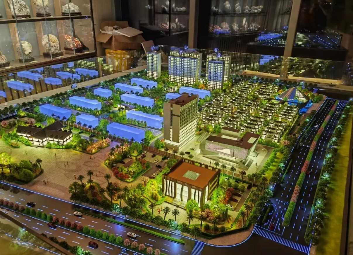
Let us break down what makes a model effective for official use.
Accurate Land Use Zoning
Standardized colors (yellow for residential, red for commercial, blue for industrial, green for open space).
A permanent legend panel.
Transportation Networks
Roads, highways, bike lanes, pedestrian paths, transit lines (bus, light rail, subway).
Level of detail appropriate for the scale (typically 1:2,000 to 1:10,000).
Utilities and Critical Infrastructure
Water treatment plants, power substations, waste facilities, telecom towers.
Shown with simple, universal symbols.
Public Facilities
Schools, hospitals, police stations, fire stations, libraries, parks, government buildings.
Labeled with numbers matching a legend.
Future Growth Areas
Phased development zones in dashed outlines or translucent blocks.
Clearly distinguished from existing conditions.
Topography and Environmental Data
Contour lines, flood zones, wetlands, tree canopy.
Essential for environmental impact reviews.
Interactivity for Public Hearings
Removable zoning overlays.
LEDs to highlight proposed projects.
A laser pointer or wooden stick for speakers.
A well‑designed City Planning Scale Model is a public communication tool, not just an internal reference.
Materials for Government Planning Models
Government models prioritize clarity, durability, and ease of update.
Laser‑cut MDF or acrylic – For building footprints.
Colored acrylic sheets – For zoning colors (standardized palette).
Fine sand and textured paint – For ground and open space.
Printed vinyl – For road names, symbols, and legends.
Clear acrylic rods – For future vertical elements (proposed towers).
Low‑voltage LEDs – For highlighting specific zones or transit corridors.
Reinforced MDF or aluminum base – For long‑term stability.
Avoid overly detailed landscaping – it distracts from zoning data and adds unnecessary cost.
The Custom Production Process for Government Clients
How is a government‑commissioned planning model made?
Here is the typical workflow.
Step 1: Data Collection and Review
You provide GIS data, zoning maps, aerial imagery, and infrastructure plans.
The model maker digitizes and simplifies for the chosen scale.
Step 2: Scale Selection and Table Sizing
Common scales: 1:2,000 for a medium‑sized district, 1:5,000 to 1:10,000 for a whole city.
Table size must fit in council chambers or planning offices.
Step 3: Base and Terrain
A large reinforced base (often aluminum honeycomb for large spans).
Topography sculpted from foam if needed (hills, floodplains).
Step 4: Zoning and Land Use Application
Colored acrylic sheets or painted areas represent zones.
A legend panel matches colors to land use types (standard municipal conventions).
Step 5: Building Massing
Buildings shown as simple blocks – height indicated by block thickness or color coding.
Step 6: Transportation and Utilities
Roads painted or inlaid with fine sand.
Transit lines printed or etched.
Utility symbols added as small acrylic icons.
Step 7: Labeling and Legend
A permanent legend attached to the base or on a nearby wall.
Numbered icons on the model correspond to the legend.
Step 8: Quality Control and Public Display Prep
The model is inspected for legibility from 1 meter away.
A low acrylic railing or clear cover is installed for protection.
A custom City Planning Scale Model typically takes 10 to 16 weeks from data delivery to installation.
Applications in Government
Where are these models used?
Public Hearings and Town Hall Meetings
Residents gather around the model.
Their feedback becomes specific: “I oppose the zoning change on block 12 because…”
City Council Deliberations
Council members point at the model.
They understand the spatial impact of zoning decisions.
Interdepartmental Coordination
Planning, traffic, water, parks, and police all use the same reference.
Grant Applications
State and federal agencies require clear visualizations.
A model strengthens funding proposals.
Disaster Preparedness and Emergency Management
Identify evacuation routes, shelter locations, and vulnerable zones.
Academic Research Collaborations
An Urban Planning Sand Table Model used by a university research team can share data with the government model – ensuring consistency.
Case Study: Planning Model Secures $50M State Grant
A mid‑sized city needed a new transit corridor and affordable housing overlay.
The state grant required demonstrable community support.
The city commissioned a City Planning Scale Model at 1:3,000 scale, covering a 2m x 3m area.
The model showed existing conditions in grey, proposed transit in blue, and housing zones in yellow.
During four public hearings, the model was the centerpiece.
Citizens pointed and asked specific questions.
Support levels increased from 45% to 78%.
The state grant was approved.
The model cost 50 million.
Cost Factors for Government Planning Models
Government budgets vary.
Costs depend on:
Area covered – 5 sq km vs. 500 sq km.
Scale – 1:2,000 (more detail) costs more than 1:10,000.
Terrain complexity – Flat vs. hilly (sculpting time).
Number of zoning categories – More colors and legends add work.
Interactivity – Static vs. removable overlays or LED highlighting.
Durability – Public‑handling requires reinforced construction.
Typical range: 120,000 for a large, detailed city‑wide model with topography, LEDs, and public‑safe railing.
How to Choose a Model Maker for Government Projects
Government procurement requires experienced vendors.
Past work with cities or counties – Ask for references from other municipalities.
Understanding of zoning conventions – Standard colors and symbols.
Ability to handle large‑scale GIS data – Not just architectural CAD.
Compliance with public safety – No sharp edges, stable base.
References from government clients – Call at least two.
Ask for a sample of a zoning legend and how they distinguish existing vs. proposed conditions.
Maintaining and Updating Your Planning Model
Cities change.
Your model should too.
Modular terrain tiles – Swap out flood zones or new subdivisions.
Replaceable zoning stickers – Vinyl overlays can be changed as ordinances update.
Annual review – Compare model to new GIS data.
Budget for updates – Set aside 5–10% of original cost every 5 years.
For cost‑effective updates, a Modular Architectural Sand Table Model is ideal – government agencies should request modular construction from the start.
Display Tips for Public Hearings
Low, Stable Pedestal with Locking Casters
Move the model to different hearing rooms.
Waist height for wheelchair access.
Even, Shadow‑Free Lighting
Ceiling‑mounted LED panels.
Avoid colored spotlights – they distort zoning colors.
Removable Legend Panel
Place on an easel next to the model.
Use large type (minimum 18pt).
Handheld Pointers
Provide non‑laser pointers (wooden sticks) to avoid eye safety issues.
Residents can point without stepping close.
Acrylic Railing, Not a Full Cover
People need to touch the railing, not the model.
A cover prevents interaction – use a low railing instead.
Common Mistakes to Avoid
Do not use realistic trees and landscaping.
They clutter the model – use simple green blocks or no vegetation.
Do not forget elevation.
A flat model misses hills, flood risks, and view corridors.
Do not choose a scale too large.
If the model exceeds 3m x 4m, people cannot see the far edge.
Do not skip a legend.
Without a legend, zoning colors are meaningless to the public.
Do not ignore future phases.
Proposed developments should be visually distinct (dashed outlines, translucent blocks).
Do not purchase a model without an update plan.
A static model becomes obsolete in 5–10 years.
Integrating with Other Model Types for Government
A single planning model may not cover every need.
Other types complement it.
A Premium Quality Architectural Sand Table Model with museum‑grade finishes might be commissioned for a mayor’s office or visitor center – separate from the public hearing model.
A Handmade Architectural Building Scale Model could be used for a historic district overlay study, where artisan texture matters.
For ongoing updates, a Modular Architectural Sand Table Model allows terrain tiles and building blocks to be swapped as the city evolves.
When procuring multiple models for different districts or departments, governments turn to Architectural Scale Model Wholesale suppliers to reduce per‑unit cost.
Each type serves a different budget and audience.
Future Trends in Government Planning Models
Live data integration – LEDs show real‑time traffic, air quality, or transit delays.
Augmented reality – Scan the model with a tablet to see demographic data or 3D building renders.
Open data exports – The model’s digital twin is made publicly available online.
Modular, crowd‑sourced updates – Citizens propose changes via an app; planners review and update the physical model accordingly.
Yet the core remains.
Citizens and council members need to see and touch the future of their city.
A physical planning model does that best.
Conclusion
A custom City Planning Scale Model is a powerful investment for any government agency.
It builds public trust, streamlines approvals, and coordinates internal teams.
Choose a scale that balances detail with coverage.
Use clear zoning colors and a simple legend.
Plan for modular updates.
Whether you need a model for a district plan, a city‑wide general plan, or a transit corridor study, start the procurement process early.
Engage a maker with government experience.
Request references and a sample legend.
Your residents will understand.
Your council will decide faster.
Your city will be better planned.
And remember – whether you need an Urban Planning Sand Table Model for a specific department, a Premium Quality Architectural Sand Table Model for the mayor’s office, a Handmade Architectural Building Scale Model for a historic overlay, a Modular Architectural Sand Table Model for ongoing updates, or Architectural Scale Model Wholesale for multiple districts, the core principles remain the same. But for government‑wide planning, the dedicated city planning scale model is essential.


